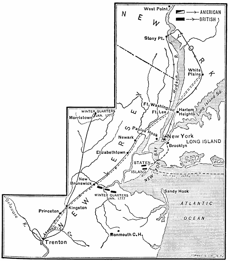
Description: A map showing the area of the New York and New Jersey campaign (1776) during the American Revolutionary War. The map shows the British landing on Staten Island in June, 1776, the advance across the Narrows to Brooklyn, Washington's retreat to Harlem Heights and White Plains, Howe's engagement at White Plains and return to capture Fort Washington and Fort Lee, Washington's retreat to Stony Point, his advance to Trenton, the crossing of the Delaware and the Battle of Trenton, the route of Cornwallis to Trenton, the winter quarters of Washington at Morristown, New Jersey, and the British winter quarters near New Brunswick (January 1777).
Place Names: Early America 1400-1800, Brooklyn, �Elizabethtown, �Long Island, �Newark, �New Jersey, �New York, �Princeton, �Stony Point, �Trenton, �White Plains, �American Revolution, �Englis
ISO Topic Categories: oceans,
location,
inlandWaters
Keywords: Campaigns in New York and New Jersey, political, �historical, �transportation, kAmericanRevolution, local jurisdictions, water routes,
roads, American Revolution, oceans,
location,
inlandWaters, Unknown, 1776
Source: Jacques W. Redway, F.R.G.S., The Redway School History (New York, NY: Silver, Burdett and Company, 1911) 155
Map Credit: Courtesy the private collection of Roy Winkelman |
|