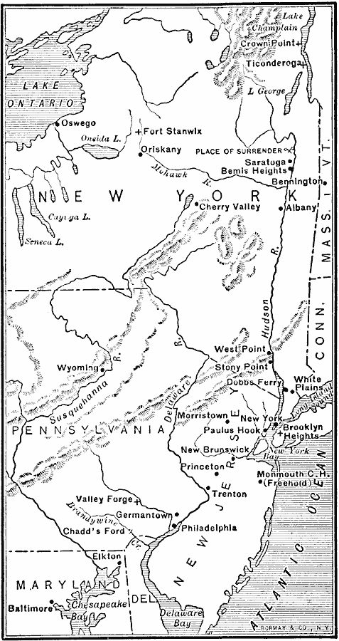
Description: A map of parts of New York, New Jersey, Pennsylvania, and Maryland involved in the early years of the American Revolutionary War. The map shows cities and towns, rivers and terrain, forts, and battle sites of the region, including Crown Point, Ticonderoga, Fort Stanwix, Oriskany, the place of Burgoyne's surrender, Saratoga, Bemis Heights, West Point, Brooklyn Heights, Morristown, Monmouth, Trenton, Valley Forge, Philadelphia, Chadd's Ford, and the landing point of Howe at Elkton, Maryland.
Place Names: Early America 1400-1800, Connecticut, �Delaware, �Maryland, �New Jersey, �New York, �Pennsylvania, �Vermont, �American Revolutio
ISO Topic Categories: oceans,
location,
inlandWaters
Keywords: The Campaigns in the Middle States, political, �historical, �transportation, kAmericanRevolution, local jurisdictions, water routes,
roads, American Revolution, oceans,
location,
inlandWaters, Unknown, 1777–1778
Source: Jacques W. Redway, F.R.G.S., The Redway School History (New York, NY: Silver, Burdett and Company, 1911) 159
Map Credit: Courtesy the private collection of Roy Winkelman |
|