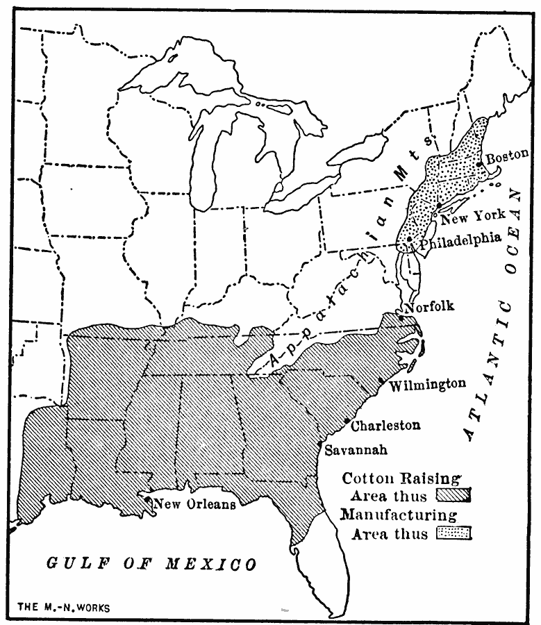
Description: A map from 1911 of the eastern United States showing the chief cotton–growing regions (Southern States) and the manufacturing districts where cotton products are produced (Northeastern States). The map shows the important ports used to transport the raw cotton in the South (New Orleans, Savannah, Charleston, Wilmington, and Norfolk) to the mills in the North (Philadelphia, New York, and Boston).
Place Names: Agriculture, Alabama, �Arkansas, �Boston, �Florida, �Georgia, �Louisiana, �Massachusetts, �Mississippi, �New Orleans, �North Carolina, �Pennsylvania, �South Carolina, ��cotto
ISO Topic Categories: oceans,
location,
inlandWaters
Keywords: The Regions of Cotton Raising and Manufacturing Areas, statistical, kAgriculture, kIndustry, agriculture,
industry,
economic, oceans,
location,
inlandWaters, Unknown, 1911
Source: Jacques W. Redway, F.R.G.S., The Redway School History (New York, NY: Silver, Burdett and Company, 1911) 236
Map Credit: Courtesy the private collection of Roy Winkelman |
|