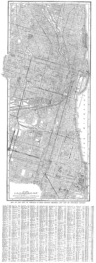
Description: A city plan from 1914 of greater Chicago showing the city limits, major streets, railroads and stations, parks, major landmarks, rivers, and the shoreline of Lake Michigan. A grid reference at the bottom of the map lists the principal streets of Chicago.
Place Names: Illinois, Chicago, �Lake Michigan, �Lincoln Park, �U. S. Grant Park,
ISO Topic Categories: transportation,
inlandWaters
Keywords: Chicago, Illinois , physical, �transportation, physical features, roads,
water routes,
railroads, transportation,
inlandWaters, Unknown, 1914
Source: , The New Encyclopedic Atlas and Gazetteer of the World (New York, NY: P. F. Collier and Son, 1914) 162-163
Map Credit: Courtesy the private collection of Roy Winkelman |
|