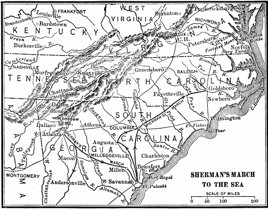
Description: A map of Georgia, South Carolina, and North Carolina showing the routes of Union General Sherman's ‘March to the Sea’ from Atlanta to Savannah (November 15 to December 21, 1864), and his march to Raleigh. The map shows state capitals, including Milledgeville, Georgia, major cities and towns, the prisoner of war camps at Andersonville and Millen, railroads, terrain features, and rivers of the area.
Place Names: Civil War, Richmond, �Raleigh,�Augusta, �Charleston, �Norfolk, �Frankfort, �Savanna
ISO Topic Categories: boundaries,
intelligenceMilitary,
inlandWaters,
location,
oceans,
transportation
Keywords: Sherman's March to the Sea, physical, �political, �transportation, �historical, physical features, major political subdivisions, roads, Civil War, boundaries,
intelligenceMilitary,
inlandWaters,
location,
oceans,
transportation, Unknown, 1864
Source: Charles Kendall Adams, A History of the United States (Boston, MA: Allyn and Bacon, 1909) 429
Map Credit: Courtesy the private collection of Roy Winkelman |
|