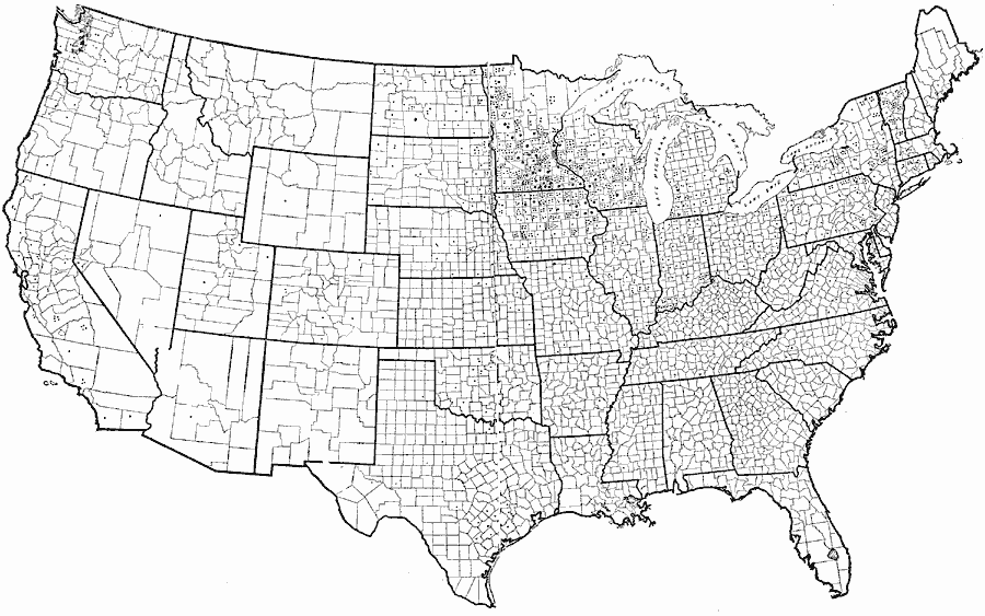
Description: Cooperative creameries in the United States. Small dot = 1 creamery; large dot = 10 creameries.
Place Names: Agriculture, dairy product
ISO Topic Categories: boundaries,
location,
farming
Keywords: Cooperative Creameries in the United States, physical, �political, �statistical, physical features, country borders,
county borders,
major political subdivisions, agriculture, boundaries,
location,
farming, Unknown, 1913
Source: United States Department of Agriculture, Yearbook of the United States Department of Agriculture (Washington, DC: Government Printing Office, 1913) 244
Map Credit: Courtesy the private collection of Roy Winkelman |
|