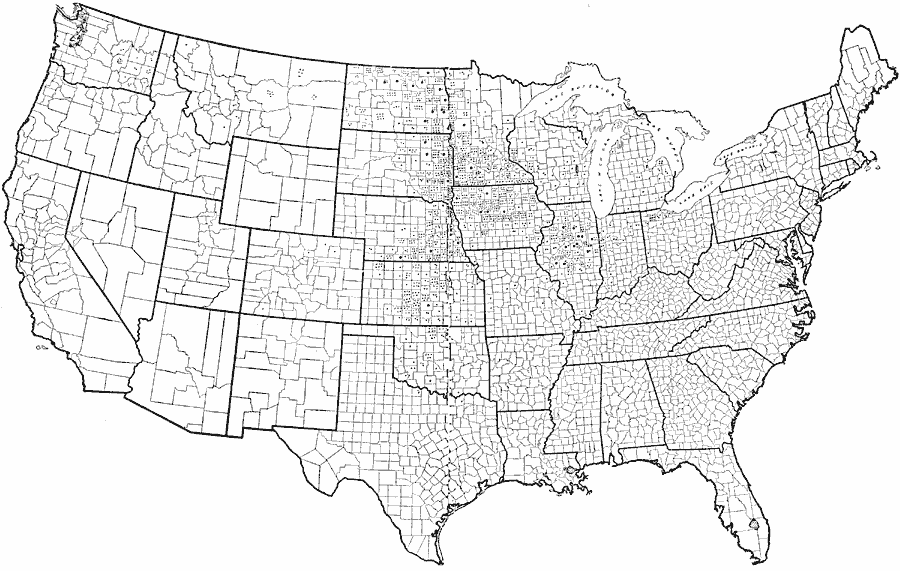
Description: Showing the distribution of farmer's cooperative elevators in the United States. Small dot = 1 elevator; large dot= 10 elevators.
Place Names: Agriculture,
ISO Topic Categories: farming,
location,
boundaries
Keywords: Farmers' Cooperative Elevators in the United States, political, �statistical, major political subdivisions,
county borders, agriculture, farming,
location,
boundaries, Unknown, 1913
Source: United States Department of Agriculture, Yearbook of the United States Department of Agriculture (Washington, DC: Government Printing Office, 1913) 248
Map Credit: Courtesy the private collection of Roy Winkelman |
|