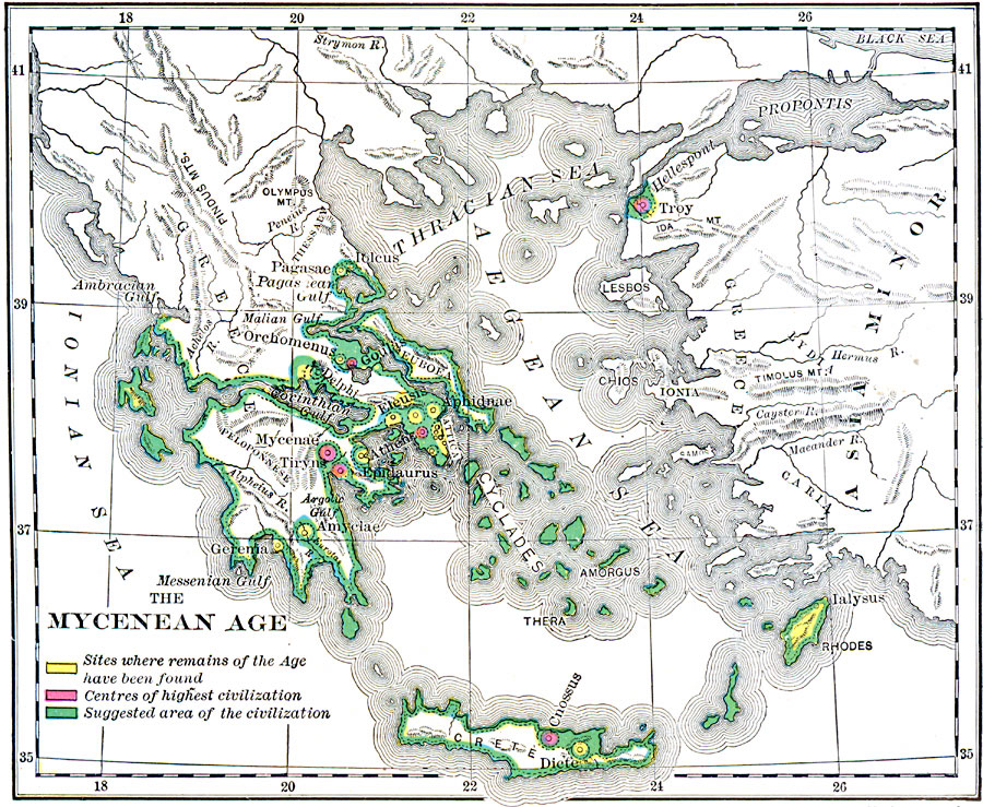
Description: A map of Greece and the Aegean during the Mycenaean Age (1550–1150 BC), showing the suggested areas of civilization, the centers of highest civilization, and sites where remains of the Mycenaean Age have been found.
Place Names: Greece, Athens, �Troy, �Delphi, �Gereni
ISO Topic Categories: boundaries,
oceans,
location,
inlandWaters
Keywords: The Mycenean Age, physical, �political, �statistical, kAncientGreece, physical features, major political subdivisions, population, boundaries,
oceans,
location,
inlandWaters, Unknown, 1550–1150 BC
Source: George Willis Botsford, Ph. D., A History of Greece (London, : The Macmillan Company, 1912) 7
Map Credit: Courtesy the private collection of Roy Winkelman |
|