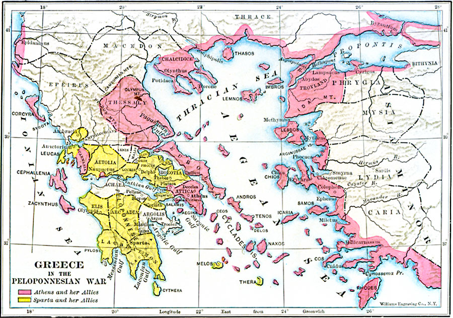
Description: A map of Greece and Asia Minor during the Peloponnesian War (431–404 BC), color–coded to show the territories of Athens, Sparta, and their allies.
Place Names: Greece, Athens, �Sparta, �Olympia, �Attica, �Argos, �Delphi, �Abydo
ISO Topic Categories: intelligenceMilitary,
inlandWaters,
location,
oceans,
boundaries
Keywords: Greece in the Peloponnesian War, physical, �political, �peloponnesian war,kAncientGreece, physical features, major political subdivisions, other military, intelligenceMilitary,
inlandWaters,
location,
oceans,
boundaries, Unknown, 431–404 BC
Source: George Willis Botsford, Ph. D., A History of Greece (London, : The Macmillan Company, 1912) 195
Map Credit: Courtesy the private collection of Roy Winkelman |
|