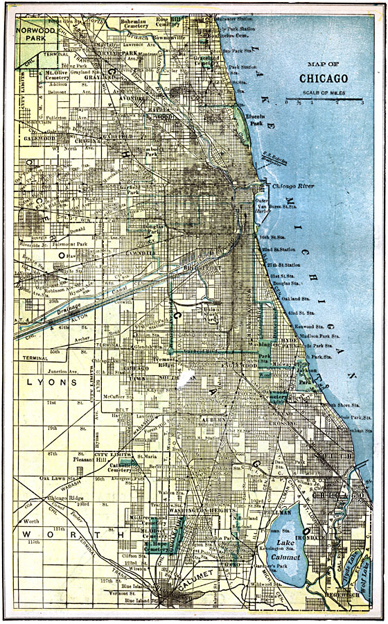
Description: A city plan from 1903 of Chicago and vicinity showing the city limits, major streets, neighboring cities and towns, the western drainage canal, parks, Union stock yards, major landmarks, and the shoreline of Lake Michigan.
Place Names: Illinois, Chicago, �Calume
ISO Topic Categories: transportation,
structure,
boundaries,
inlandWaters,
location,
oceans
Keywords: Chicago, physical, �political, �transportation, physical features, local jurisdictions, roads, transportation,
structure,
boundaries,
inlandWaters,
location,
oceans, Unknown, 1903
Source: W. R. Hearst, The American Almanac, Yearbook Cycopedia and Atlas 2nd ed (Chicago, IL: Hearst's Chicago American, 1903) 409
Map Credit: Courtesy the private collection of Roy Winkelman |
|