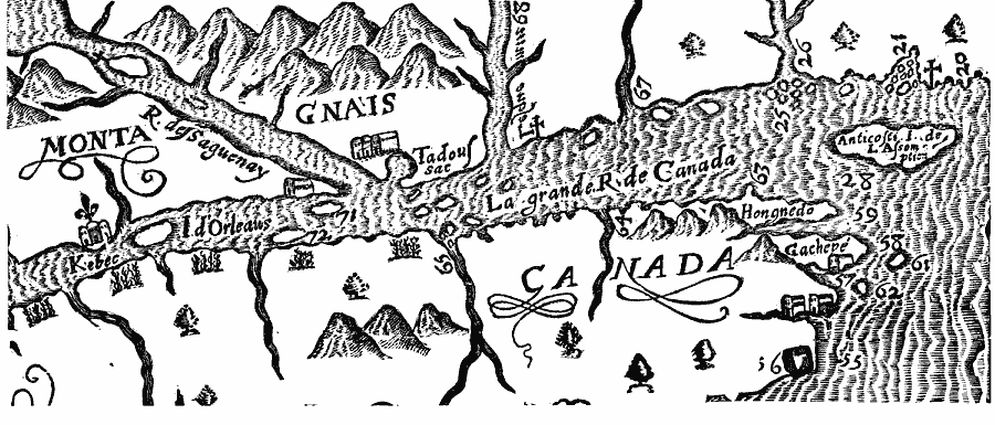
Description: A facsimile of a portion of the map by Marc Lescarbot (1609) showing the St. Lawrence River from Kebec (Quebec) to the Anticosti Isle de I. Assomption (Anticosti Island) in the Gulf of St. Lawrence. This portion of the map shows La grande R. de Canada (St. Lawrence River), Isle d'Orleans, R. des Saguenay (Saguenay River), the Iroquois village of Tadoussac, and the points of land Hongnedo and Gachepé at the eastern tip of the Gaspé Peninsula.
Place Names: Canada, Quebe
ISO Topic Categories: oceans,
location,
inlandWaters
Keywords: The St. Lawrence, borders, �physical, oceans,
location,
inlandWaters, Unknown, 1609
Source: Justin Winsor, Narrative and Critical History of America (vol. 4) (Boston, MA: Houghton, Mifflin, and Company, 1884) 117
Map Credit: Courtesy the private collection of Roy Winkelman |
|