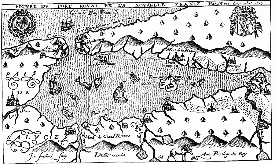
Description: A facsimile of a map from Father Marc Lescarbot of Port Royal (Nova Scotia) around 1609, before the British campaigns in the area to expel the French settlers in 1613. This map shows the entrance to the Port Royal Basin from the Bay of Fundy, fortifications and cannon placements, church, and settlements. The architecture images are fanciful considering the materials available at the time.
Place Names: Canada, St. Croi
ISO Topic Categories: oceans,
location,
inlandWaters
Keywords: Port Royal, or Annapolis Basin (after Lescarbot), borders, �physical, kEarlyMapsFacsimile, oceans,
location,
inlandWaters, Unknown, 1609
Source: Justin Winsor, Narrative and Critical History of America (vol. 4) (Boston, MA: Houghton, Mifflin, and Company, 1884) 140
Map Credit: Courtesy the private collection of Roy Winkelman |
|