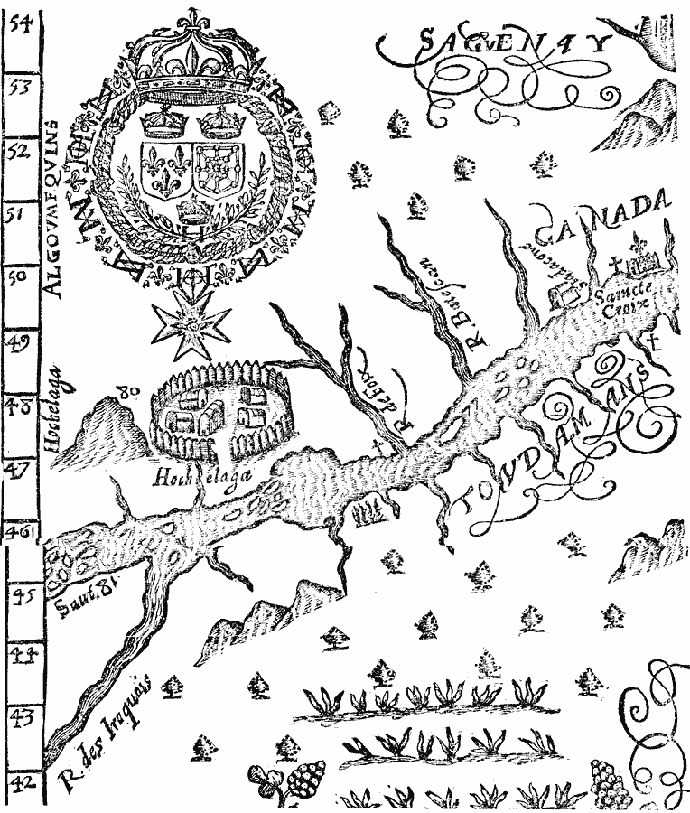
Description: A facsimile of a portion of the map by Marc Lescarbot (1609) showing the Iroquois village of Hochelaga on the St. Lawrence River, site of present–day Montreal. The map shows the nearby Mountain, rivers, Jesuit missions, and the Saincte Croix church to the east.
Place Names: Canada, Montreal, �Quebe
ISO Topic Categories: oceans,
location,
inlandWaters
Keywords: The Site of Montreal, physical, kEarlyMapsFacsimile, oceans,
location,
inlandWaters, Unknown, 1609
Source: Justin Winsor, Narrative and Critical History of America (vol. 4) (Boston, MA: Houghton, Mifflin, and Company, 1884) 304
Map Credit: Courtesy the private collection of Roy Winkelman |
|