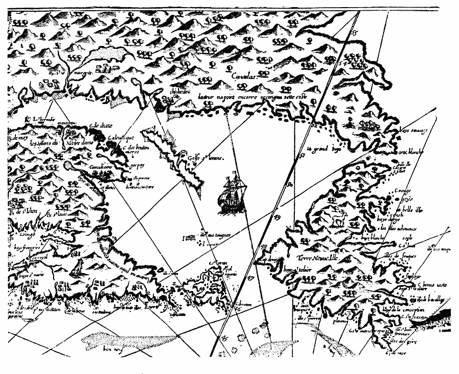
Description: A facsimile of the eastern part of Champlain's map (1612) showing the Gulf of St. Lawrence, Newfoundland, Prince Edward Island, Cape Breton, and Nova Scotia.
Place Names: Canada,
ISO Topic Categories: oceans,
location,
inlandWaters
Keywords: Easterly Portion of Champlain's Map, borders, �physical, kEarlyMapsFacsimile, physical features, oceans,
location,
inlandWaters, Unknown, 1612
Source: Justin Winsor, Narrative and Critical History of America (vol. 4) (Boston, MA: Houghton, Mifflin, and Company, 1884) 380
Map Credit: Courtesy the private collection of Roy Winkelman |
|