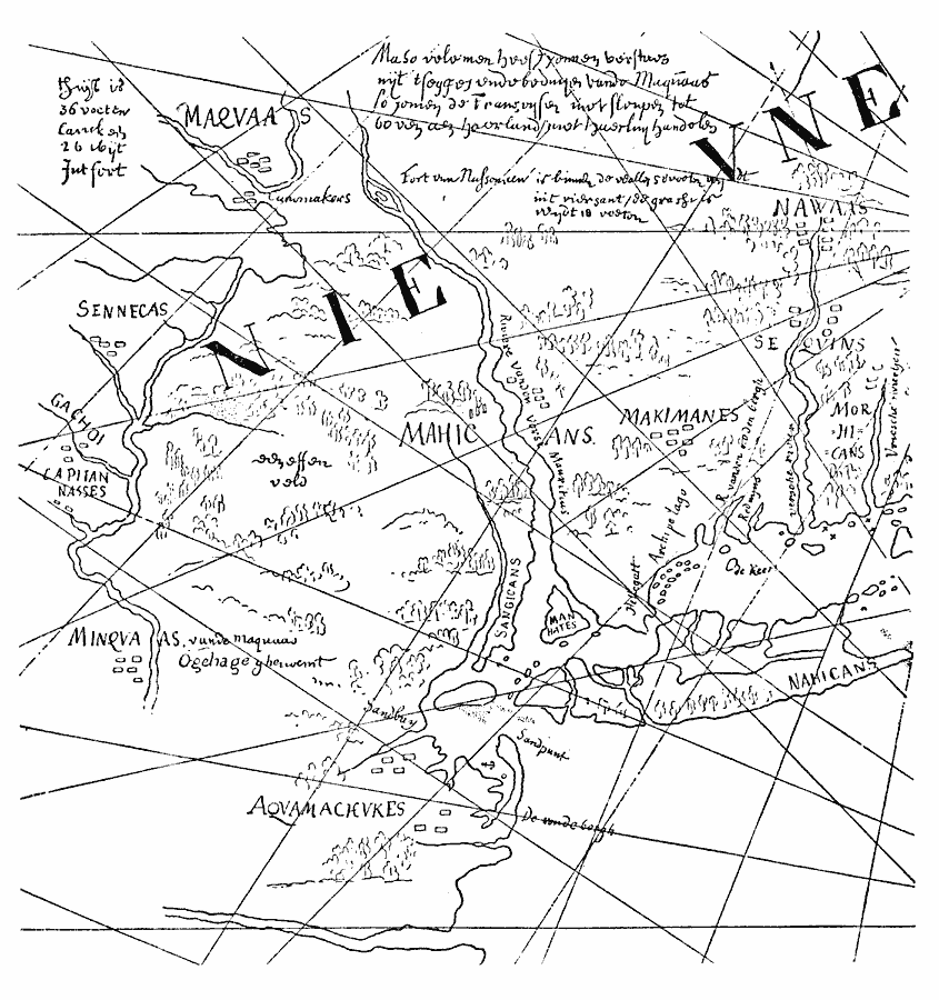
Description: A facsimile of a map discovered by Brodhead (1850) in the archives at the Hague, known as "The Figurative Map," cartographer unknown and dated 1616, one of a pair of similar maps. This is the oldest map of the territory now comprising the States of New York, New Jersey, and Delaware. "Notwithstanding the great care and detail exhibited in them, they are necessarily inaccurate, but highly interesting and instructive, as they indicate as they indicate the location of the several Indian tribes at the time of the arrival of the Dutch and of the Spaniards before them. The names given on these maps to some of the Indian tribes are so unmistakably of Spanish origin, that it is hard to believe they were not first applied by the Spaniards, and afterwards repeated by the Indians to the before–mentioned three Dutch prisoners among the Mohawks. We find one tribe called ‘Capitanasses,’ while in colloquial Spanish capitanázo means a great warrior; another, whom the Dutch later knew as Black Minquas, is designated by the name of ‘Gachos,’ the Spanish word gacho being applied to black cattle. Still another is called the ‘Canoomakers;’ canoa being a word of the Indian tongues of South America, the North American Indian could only have learned it from the Spaniards, and in turn have taught its meaning to the Dutch." — Winsor, 1884, p.434.
Place Names: Early America 1400-1800, Delaware, �New Jersey, �New York, �New York State, �Discovery, �Native American
ISO Topic Categories: oceans,
location,
inlandWaters
Keywords: From the Figurative Map, borders, �physical, kNativeAmerican, physical features, oceans,
location,
inlandWaters, Unknown, 1616
Source: Justin Winsor, Narrative and Critical History of America (vol. 4) (Boston, MA: Houghton, Mifflin, and Company, 1884) 433
Map Credit: Courtesy the private collection of Roy Winkelman |
|