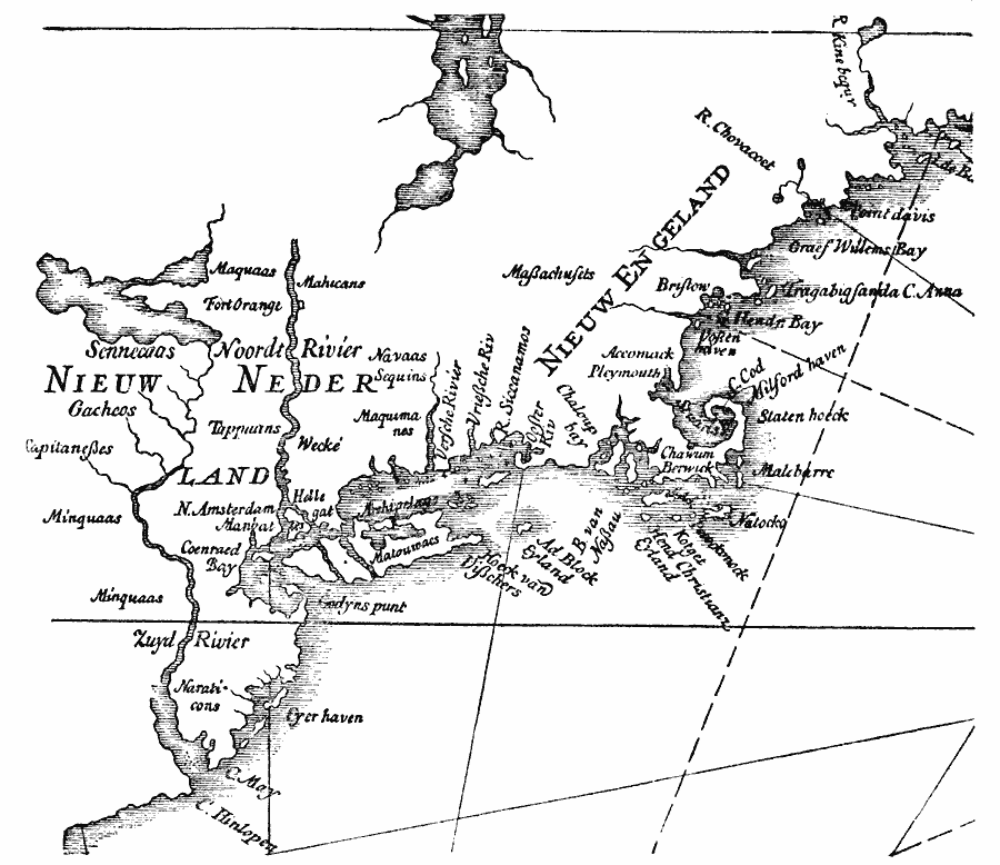
Description: A facsimile of a portion of the Dutch map by Johannes de Laet (1630) showing the territories claimed by New Netherlands and New England, from Cape Hinlopen and Cape May on Delaware Bay north to the coast of Maine. The map shows Zuyd Rivier (South River or Delaware), Long Island, Manhattan Island, New Amsterdam, Fort Orange on the Noordt Rivier (North River or Hudson), Cape Cod, Pleymouth (Plymouth), and Bristow (Boston). The Native American tribal lands are indicated on the map.
Place Names: Early America 1400-1800, Boston, �New York, �Discovery, �New Netherland, �Massachusetts, �Dutc
ISO Topic Categories: oceans,
location,
inlandWaters
Keywords: Part of De Laet's Map, borders, �physical, kNativeAmerican, physical features, oceans,
location,
inlandWaters, Unknown, 1630
Source: Justin Winsor, Narrative and Critical History of America (vol. 4) (Boston, MA: Houghton, Mifflin, and Company, 1884) 436
Map Credit: Courtesy the private collection of Roy Winkelman |
|