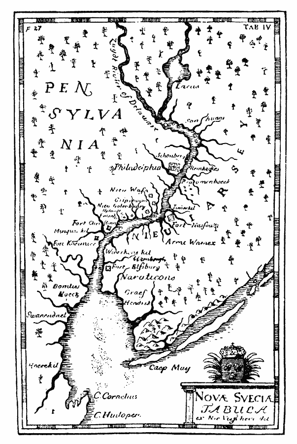
Description: A facsimile of an early map by Claes Jannson Visscher (1651) of Nova Svecia (New Sweden) showing the Delaware Bay and River, Pensylvania [sic], Nieu Iarsey (New Jersey), Cape Henlopen, Cape May, Fort Elfsburg, Fort Kasimir, Fort Christina, and Philadelphia.
Place Names: Early America 1400-1800, Delaware, �New Jersey, �New York, �Pennsylvania, �Colonial America, �Discovery, �Swedish, �New Swede
ISO Topic Categories: oceans,
location,
inlandWaters
Keywords: Visscher's Map of the Delaware Bay and River, and New Sweden, borders, �physical, kEarlyMapsFacsimile, physical features, oceans,
location,
inlandWaters, Unknown, 1651
Source: Justin Winsor, Narrative and Critical History of America (vol. 4) (Boston, MA: Houghton, Mifflin, and Company, 1884) 467
Map Credit: Courtesy the private collection of Roy Winkelman |
|