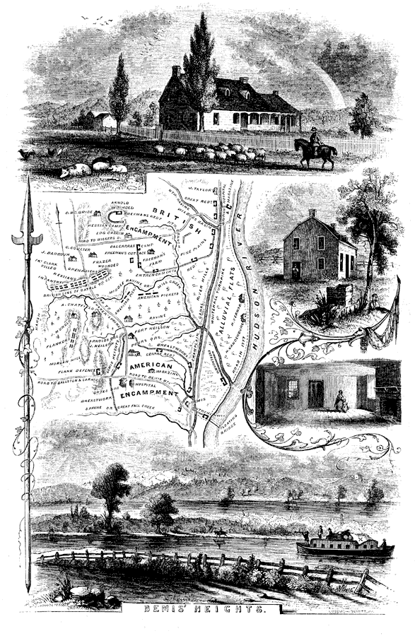
Description: A map of the area around Bemis' Heights along the Hudson River, site of the Second Battle of Saratoga (October 7, 1777). The map shows significant locations in the vicinity around Bemis' Heights, such as the British and the American encampments, Fort Neilson, the British entrenchments, and the sites where Benedict Arnold was wounded and British Brigadier Simon Fraser was mortally wounded.
Place Names: Early America 1400-1800, Hudson River, �Champlain Canal, �Alluvial Flats, �Great Fall Creek, ��American Revolutio
ISO Topic Categories: inlandWaters,
structure,
intelligenceMilitary
Keywords: Bemis' Heights, physical, �historical, kAmericanRevolution, kBattle, physical features, American Revolution, inlandWaters,
structure,
intelligenceMilitary, Unknown, 1777
Source: Benson J. Lossing, Pictorial Field-Book of the Revolution Vol. I (New York, NY: Harper and Brothers, 1851) 46
Map Credit: Courtesy the private collection of Roy Winkelman |
|