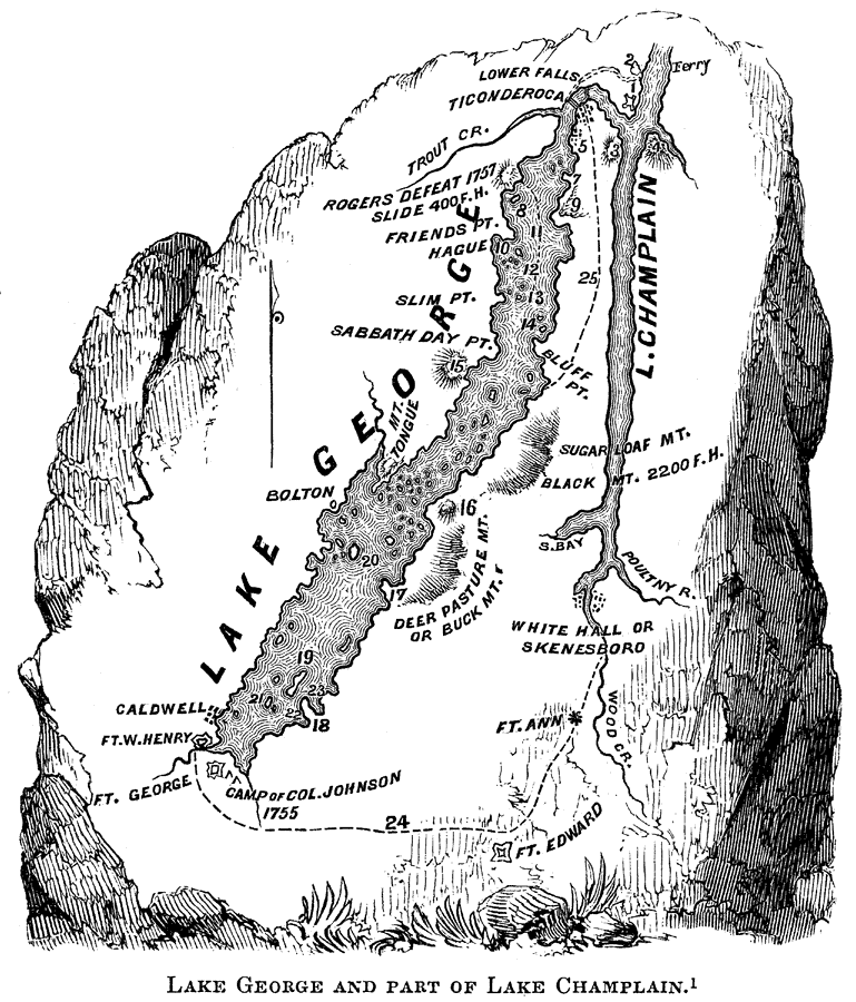
Description: A map of the area around Lake Champlain and Lake George, New York, showing the site of the Fort William Henry Battle and Massacre (1757) during the French and Indian War. The map shows the important landmarks and events leading up to this battle, and is keyed to show: (1) Fort Ticonderoga; (2) Fort Howe; (3) Mount Defiance; (4) Mount Independence; (5) Village of Alexandria; (7) Black Point; (8) Juniper Island; (9) Anthony's Nose; (10) McDonald's Bay; (11) Roger's retreat on the ice to Fort William Henry; (12) Cook's Islands; (13) Scotch Bonnet; (14) Odell Island; (15) Buck Mountain and Rattlesnake Dens; (16) Shelving Rock; (17) Phelps's Point; (18) Long Point; (19) Long Island; (20) Dome Island; (21) Diamond Island; (22) Dunham's Bay; (23) Harris's Bay; and (24) the route of Dieskau from Skenesborough to Fort William Henry.
Place Names: Early America 1400-1800, Lake George, �Lake Champlain, �Fort Edward, �Fort George, �Fort William Henry, �Bolton, ���American Revolutio
ISO Topic Categories: inlandWaters,
location
Keywords: Lake George and Part of Lake Champlain, physical, �historical, physical features, American Revolution, inlandWaters,
location, Unknown, 1757
Source: Benson J. Lossing, Pictorial Field-Book of the Revolution Vol. I (New York, NY: Harper and Brothers, 1851) 115
Map Credit: Courtesy the private collection of Roy Winkelman |
|