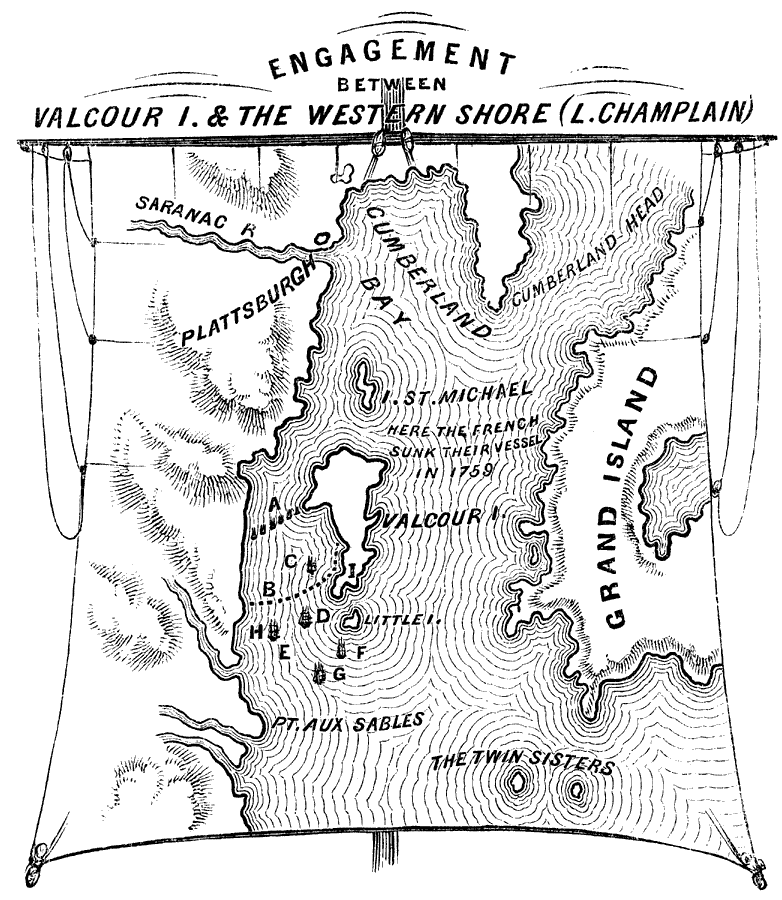
Description: A detail map of central Lake Champlain near Plattsburgh showing the Battle of Valcour Island (October 11–13, 1776) between the British and American navies. The map is keyed to show (A) the American fleet under Arnold, (B) 21 gun-boats, (C) schooner Carleton, 12 six pounders, (D) ship Inflexible, 18 twelve pounders, (E) anchorage of the British fleet during the night, to cut off the Americans' retreat, (F) radeau Thunderer, 6 twenty-four pounders and 12 six pounders, (G) gondola Loyal Convert, 7 nine pounders, (H) schooner Maria, 14 six pounders, with General Carleton on board, (I) the place where the American schooner Royal Savage, of 8 six pounders and 4 four pounders was burned. — Lossing, 1851, p.163.
Place Names: Early America 1400-1800, Grand Island, �Plattsburgh, �Saranac River, �Cumberland Bay, �Valcour Ilsand, �St. Michael, ��American Revolutio
ISO Topic Categories: inlandWaters,
location
Keywords: Engagement Between Valcour Island and the Western Shore (Lake Champlain), physical, �historical, kAmericanRevolution, kBattle, physical features, American Revolution, inlandWaters,
location, Unknown, 1776
Source: Benson J. Lossing, Pictorial Field-Book of the Revolution Vol. I (New York, NY: Harper and Brothers, 1851) 163
Map Credit: Courtesy the private collection of Roy Winkelman |
|