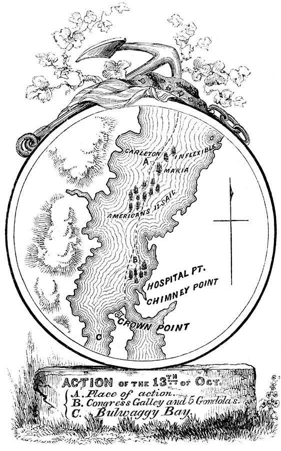
Description: A detail map of southern Lake Champlain near Fort Crown Point on the last day of the Battle of Valcour Island (October 11–13, 1776) between the British and American navies. The map shows areas of interest regarding the battles between the British vessels, Carleton, Inflexible, and Maria, and the American vessels, the Congress and the Washington on October 13, 1776. The map is keyed to show (A) the place of naval action, (B) the point off Chimney Point reached during Arnold's retreat before his ships were scuttled, and (C) Bulwaggy Bay to the west of Crown Point.
Place Names: Early America 1400-1800, Crown Point, �Chimney Point, �Bulwaggy Bay, ��American Revolutio
ISO Topic Categories: inlandWaters,
location
Keywords: Attack on the Congress and the Washington, physical, �historical, kAmericanRevolution, kBattle, physical features, American Revolution, inlandWaters,
location, Unknown, October 13, 1776
Source: Benson J. Lossing, Pictorial Field-Book of the Revolution Vol. I (New York, NY: Harper and Brothers, 1851) 164
Map Credit: Courtesy the private collection of Roy Winkelman |
|