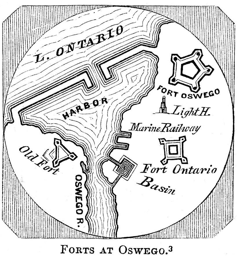
Description: A plan of the fortifications of the British trading post on the Oswego River at its mouth on Lake Ontario, constructed in 1727 and destroyed by the French in 1756. The map shows the site of the old fort on the western bank of the river, the harbor, Fort Ontario, the light house, and the site of the new Fort Oswego.
Place Names: Early America 1400-1800, Lake Ontario, �Fort Oswego, �Fort Ontario, �Old Fort, �Oswego River, ��American Revolutio
ISO Topic Categories: location,
inlandWaters,
structure,
intelligenceMilitary
Keywords: Fort Oswego, physical, �historical, physical features, American Revolution, location,
inlandWaters,
structure,
intelligenceMilitary, Unknown, 1727–1756
Source: Benson J. Lossing, Pictorial Field-Book of the Revolution Vol. I (New York, NY: Harper and Brothers, 1851) 217
Map Credit: Courtesy the private collection of Roy Winkelman |
|