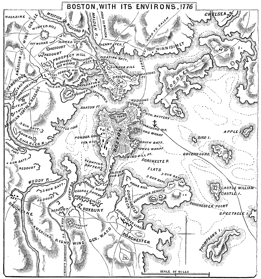
Description: A map of Boston and vicinity in 1776, showing the relative positions of hostile forces at the opening of the American Revolutionary War, and the various works thrown up during the summer and autumn of 1775, and at the beginning of 1776.
Place Names: Massachusetts, Charles River, �Muddy River, �Dorchester, �Winnisimet, �Roxbury,
ISO Topic Categories: inlandWaters,
location
Keywords: Boston, with its Environs, physical, �historical, kAmericanRevolution, physical features, American Revolution, inlandWaters,
location, Unknown, 1776
Source: Benson J. Lossing, Pictorial Field-Book of the Revolution Vol. I (New York, NY: Harper and Brothers, 1851) 566
Map Credit: Courtesy the private collection of Roy Winkelman |
|