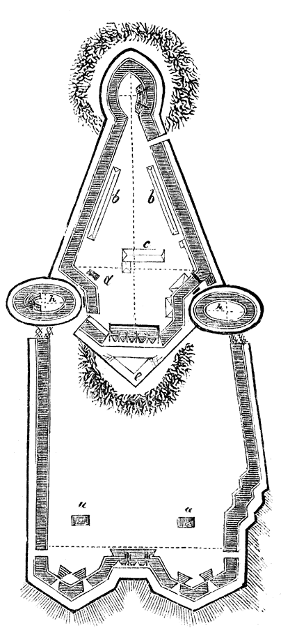
Description: A plan of the British fort on Bunker Hill. The map is keyed to show: (a) two temporary magazines; (b) barracks; (c) guard-houses; (d) magazine; (e) advanced ditch; and (h) bastions. "This was a well–built redoubt. The parapet was from six to fifteen feet broad; the ditch from fourteen to eighteen feet wide; and the banquet about four feet broad. The galleries and parapet before them were raised about twenty feet high, and the merlons at the six–gun battery in the center were about twelve feet high." — Lossing, 1851.
Place Names: Massachusetts, Bunker Hill,
ISO Topic Categories: structure,
intelligenceMilitary
Keywords: British Fort on Bunker Hill, historical, kAmericanRevolution, American Revolution, structure,
intelligenceMilitary, Unknown, 1775
Source: Benson J. Lossing, Pictorial Field-Book of the Revolution Vol. I (New York, NY: Harper and Brothers, 1851) 574
Map Credit: Courtesy the private collection of Roy Winkelman |
|