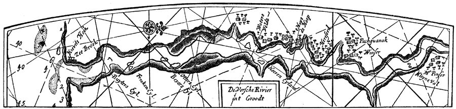
Description: A facsimile of an early Dutch map of the Connecticut River, the eastern boundary claimed by New Netherlands in 1666. The map is oriented with north to the right, and shows the early settlements and native villages, shoreline, and water depths of the river's navigable waters near the Long Island Sound.
Place Names: Early America 1400-1800, Connecticut River, �Zee Broek, �Waters Veldt, �Beyers Eyl., �Otters Eyl.,��Colonial America, �Discover
ISO Topic Categories: inlandWaters,
location
Keywords: Connecticut River, physical, kEarlyMapsFacsimile, physical features, inlandWaters,
location, Unknown, 1666
Source: Justin Winsor, Narrative and Critical History of America Vol. III (Boston, MA: Houghton, Mifflin and Company, 1884) 333
Map Credit: Courtesy the private collection of Roy Winkelman |
|