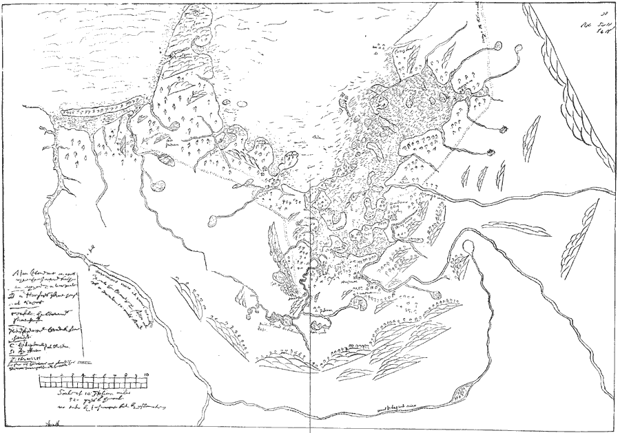
Description: A facsimile of a map by John Winthrop (1633) of the Boston area, including the Merrimac and Concord Rivers, Plum Island, and roads leading to Saugus, Salem, Winesemett, and Meadford. The map is oriented with north to the left.
Place Names: Early America 1400-1800, Merimack River, �Agawam, �Sagus, �Salem, �Winesemett, �Meadford, �Misticke, �Cape Anne, �Anasquom, �Colonial America, �Discover
ISO Topic Categories: location,
inlandWaters
Keywords: Winthrop Map, physical, kEarlyMapsFacsimile, physical features, location,
inlandWaters, Unknown, 1633
Source: Justin Winsor, Narrative and Critical History of America Vol. III (Boston, MA: Houghton, Mifflin and Company, 1884)
Map Credit: Courtesy the private collection of Roy Winkelman |
|