mapsMaps ETC Site map
 Maps ETC > North America > Canada > Canada, Newfoundland, New Brunswick, and Nova Scotia, 1492–1607
Site Map 

Canada, Newfoundland, New Brunswick, and Nova Scotia, 1492–1607

Canada, Newfoundland, New Brunswick, and Nova Scotia


Title: Canada, Newfoundland, New Brunswick, and Nova Scotia
Projection: Unknown,
Source Bounding Coordinates:
W: -73 E: -25 N: 60 S: 42

Main Map Page
Zoomify Version
B/W PDF Version
Color PDF Version
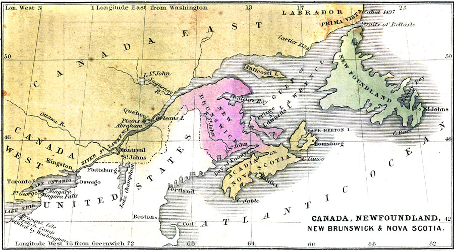
Description: Canada, Newfoundland, New Brunswick, and Nova Scotia.
Place Names: Canada, Acadia, Halifax, Montreal, Newfoundland, Nova Scotia,
ISO Topic Categories: oceans, location, inlandWaters, boundaries
Keywords: Canada, Newfoundland, New Brunswick, and Nova Scotia, borders, physical, oceans, location, inlandWaters, boundaries, Unknown, 1492–1607
Source: Charles A. Goodrich, History of the United States for Schools (Boston, MA: Hickling, Swan, and Brewer, 1859)
Map Credit: Courtesy the private collection of Roy Winkelman
SearchLicensePDF HelpGIS Help Google Earth Help Zoomify Help

 Maps ETC > North America > Canada > Canada, Newfoundland, New Brunswick, and Nova Scotia, 1492–1607
Site Map