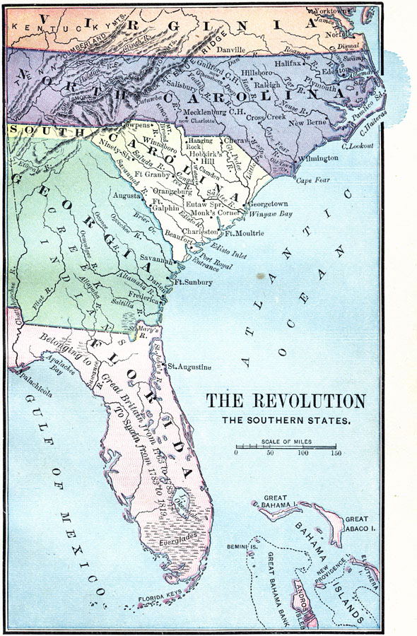
Description: A map of America's southern states during the time of the American Revolution, including North Carolina, South Carolina, and Georgia. The map shows major cities, towns, forts, battle sites, mountain systems, rivers, and coastal features of the region. The map shows Florida as belonging to Great Britain from 1763 to 1783, and to Spain from 1783 to 1819.
Place Names: Early America 1400-1800, Florida, �Georgia, �North Carolina, �South Carolina, �Virginia, �American Revolutio
ISO Topic Categories: oceans,
location,
inlandWaters
Keywords: The Revolution in the Southern States, borders, �physical, �historical, kAmericanRevolution, American Revolution, oceans,
location,
inlandWaters, Unknown, 1774–1783
Source: D.H. Montgomery, The Leading Facts of American History (Boston, MA: Ginn & Company, 1895)
Map Credit: Courtesy the private collection of Roy Winkelman |
|