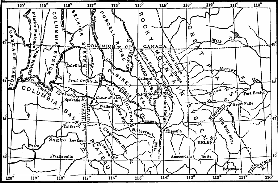
Description: A map of the northern Rockies in Montana showing the mountain systems, ranges, and intermontane trenches of the area.
Place Names: Montana, Helena, �Butte, �Anaconda, �Fort Benton, �Bozema
ISO Topic Categories: boundaries,
geoscientificInformation,
inlandWaters,
location
Keywords: Northern Rockies, political, �physical, physical features, country borders,
major political subdivisions, boundaries,
geoscientificInformation,
inlandWaters,
location, Unknown, 1911
Source: Isaiah Bowman, Ph. D, Forest Physiography (New York, NY: John Wiley and Sons, 1911) 298
Map Credit: Courtesy the private collection of Roy Winkelman |
|