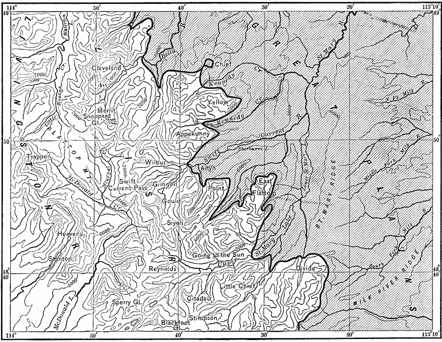
Description: A contour map of the boundaries of the Great Plains and Lewis front ranges of western Montana, showing the abrupt change in the topography. The heavy black line indicates the outcrop of the Lewis thrust plane.
Place Names: Montana, Great Plains,�western Montana, �Lewis thrust plane
ISO Topic Categories: boundaries,
elevation,
inlandWaters,
location
Keywords: Great Plains and Front Ranges, physical, physical features,
topographical, boundaries,
elevation,
inlandWaters,
location, Unknown, 1911
Source: Isaiah Bowman, Ph. D, Forest Physiography (New York, NY: John Wiley and Sons, 1911) 308
Map Credit: Courtesy the private collection of Roy Winkelman |
|