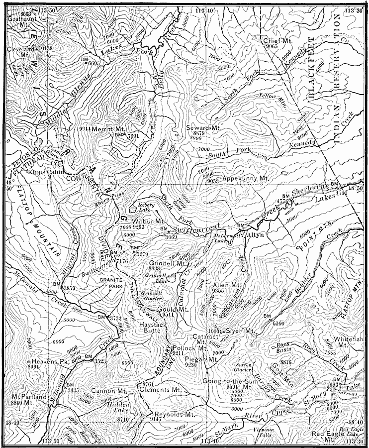
Description: A contour map of part of the Lewis Mountains of western Montana, representing typical glacial features of the range.
Place Names: Montana, Lewis Mountains, �western Montana
ISO Topic Categories: boundaries,
elevation,
inlandWaters,
location
Keywords: Lewis Mountains, physical, physical features,
topographical, boundaries,
elevation,
inlandWaters,
location, Unknown, 1911
Source: Isaiah Bowman, Ph. D, Forest Physiography (New York, NY: John Wiley and Sons, 1911) 311
Map Credit: Courtesy the private collection of Roy Winkelman |
|