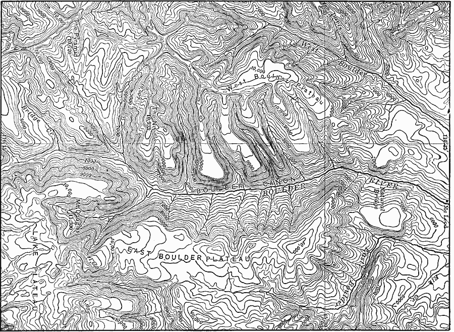
Description: A contour map from 1911 of the topography of East and West Boulder plateaus and the northern end of the Absaroka Range in southwestern Montana.
Place Names: Montana,
ISO Topic Categories: boundaries,
elevation,
inlandWaters,
location
Keywords: Boulder Plateaus, physical, physical features,
topographical, boundaries,
elevation,
inlandWaters,
location, Unknown, 1911
Source: Isaiah Bowman, Ph. D, Forest Physiography (New York, NY: John Wiley and Sons, 1911) 333
Map Credit: Courtesy the private collection of Roy Winkelman |
|