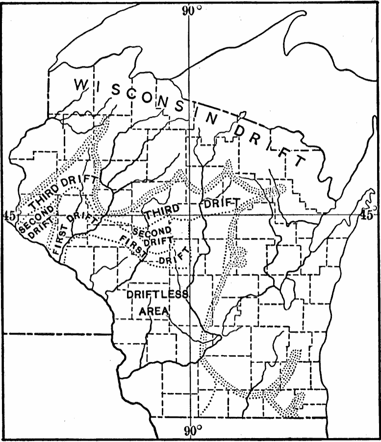
Description: A map from 1911 showing the four drift sheets of the last glacial period that covered this portion of Wisconsin. The terminal moraines of the greater ice sheets are shown, indicating the Driftless Area of Wisconsin.
Place Names: Wisconsin,
ISO Topic Categories: boundaries,
inlandWaters,
location,
geoscientificInformation
Keywords: Wisconsin Drift, physical, �political, kGlacial, physical features, major political subdivisions,
county borders, boundaries,
inlandWaters,
location,
geoscientificInformation, Unknown, 1911
Source: Isaiah Bowman, Ph. D, Forest Physiography (New York, NY: John Wiley and Sons, 1911) 470
Map Credit: Courtesy the private collection of Roy Winkelman |
|