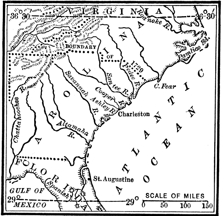
Description: A map of Georgia and the Carolinas, showing the land granted to eight English lords and gentlemen as joint proprietaries by King Charles II under the charter of 1663, which extended from the southern border of Virginia south to the 29° parallel in Florida below St. Augustine. This map also shows the boundary line established in 1729 that divided the colony into North Carolina and South Carolina.
Place Names: Early America 1400-1800, Charleston, �Florida, �Georgia, �North Carolina, �St. Augustine, �South Carolina, �Virginia,
ISO Topic Categories: location,
inlandWaters,
oceans,
boundaries
Keywords: The Carolina Grant, historical, �location, �physical, �political, physical features, major political subdivisions, historical event, location,
inlandWaters,
oceans,
boundaries, Unknown, 1665
Source: Nathaniel Wright Stephenson, An American History (Boston, MA: Ginn and Company, 1913) 84
Map Credit: Courtesy the private collection of Roy Winkelman |
|