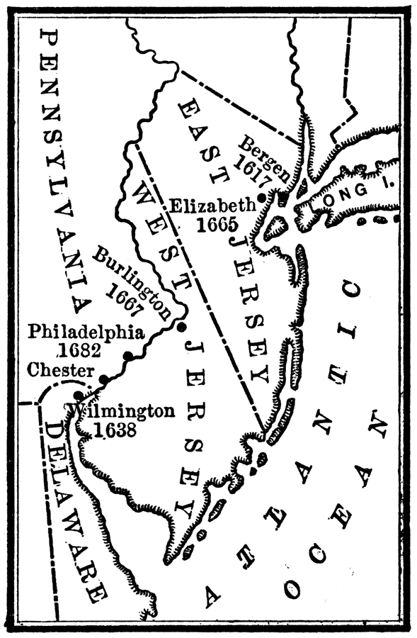
Description: A map of the New Jersey Colony between the establishment of the Dutch settlement at Bergen (1617), the acquisition, between the lower Hudson and Delaware Rivers, subdivided by the Duke of York to form East Jersey and West Jersey, and the unification of East and West Jersey in 1702. The map shows Wilmington, Delaware (settled by the Swedes as Fort Christina in 1638), the first English settlement of Elizabethtown (1665), Burlington (1667), Philadelphia (1682), the division line of the territory into East Jersey and West Jersey in 1676, and the unification under the governor of New York in 1702. The two provinces were united and became the royal province of New Jersey.
Place Names: Early America 1400-1800, Bergen, �East Jersey, �Elizabeth, �New York, �West Jersey, �English, �Colonial Americ
ISO Topic Categories: location,
inlandWaters,
oceans,
boundaries
Keywords: New Jersey, historical, �location, �physical, �political, physical features, major political subdivisions, historical event, location,
inlandWaters,
oceans,
boundaries, Unknown, 1674–1702
Source: Nathaniel Wright Stephenson, An American History (Boston, MA: Ginn and Company, 1913) 86
Map Credit: Courtesy the private collection of Roy Winkelman |
|