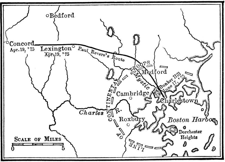
Description: A sketch map of the area between Boston and Concord, Massachusetts, showing the events leading up to the Battle of Bunker Hill (June 17, 1775). The map shows the route of Paul Revere from Boston to Concord to warn of the approach of the British (April 18, 1775), the town of Lexington, where on April 19, the "shot heard 'round the world" marked the opening of armed conflict between the British and American colonists, and the ring of Washington's Continental Troops that formed around Boston prior to the Battle of Bunker Hill (Breed's Hill).
Place Names: Early America 1400-1800, Boston, �Bunker Hill, �Cambridge, �Charlestown, �Concord, �Connecticut, �Lexington, �Massachusetts, �Medford, �Roxbury, ��American Revolution, �Colonial Americ
ISO Topic Categories: location,
inlandWaters,
oceans,
boundaries
Keywords: The Siege of Boston, historical, �location, �physical, �transportation, kAmericanRevolution, physical features, roads, American Revolution, location,
inlandWaters,
oceans,
boundaries, Unknown, 1775
Source: Nathaniel Wright Stephenson, An American History (Boston, MA: Ginn and Company, 1913) 176
Map Credit: Courtesy the private collection of Roy Winkelman |
|