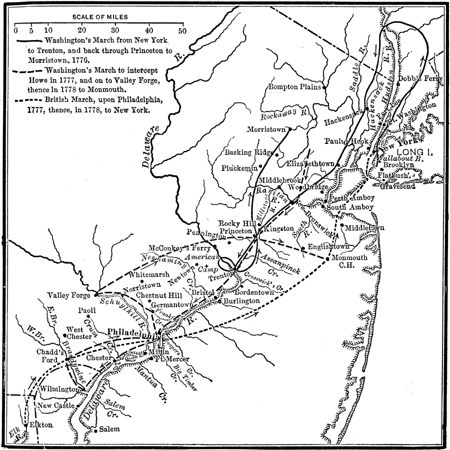
Description: A map of New Jersey and Pennsylvania showing the campaigns of General George Washington in the area between 1776 and 1778. The map is keyed to show the route of Washington's March from New York to Trenton and back through Princeton to Morristown (1776), Washington's March to intercept Howe in 1777, Valley Forge and Monmouth (1778), and the British March from Elkton to Philadelphia and then to New York.
Place Names: Early America 1400-1800, Delaware, �Monmouth, �Morristown, �New Jersey, �New York, �Pennsylvania, �Philadelphia, �Trenton, �Valley Forge, �Wilmington, � �American Revolutio
ISO Topic Categories: location,
inlandWaters,
oceans
Keywords: Washington's Campaigns, historical, �location, �physical, kAmericanRevolution, physical features, historical event,
American Revolution, location,
inlandWaters,
oceans, Unknown, 1776–1778
Source: Nathaniel Wright Stephenson, An American History (Boston, MA: Ginn and Company, 1913) 199
Map Credit: Courtesy the private collection of Roy Winkelman |
|