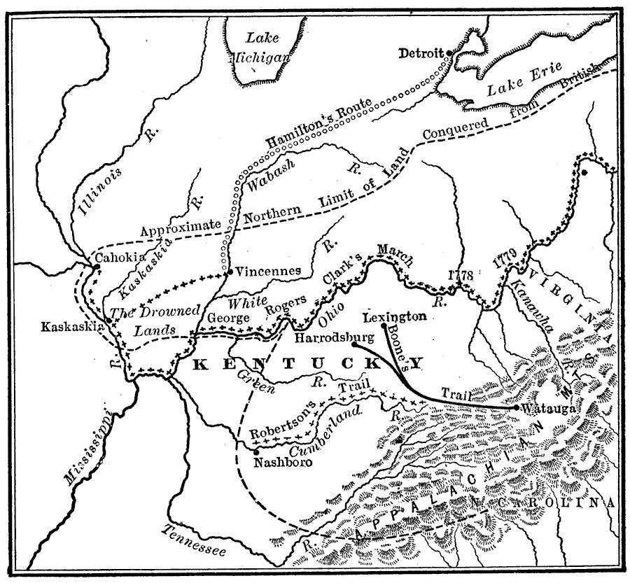
Description: A map of the Ohio country where in 1778–1779 George Rogers Clark led the Illinois Campaign to capture the British stronghold at Vincennes, marking an end to British power in the west. The map shows Clark's route along the Ohio River to the British Fort Kaskaskia on the Mississippi River (1778) and British Fort Vincennes on the Wabash River (1779). The map also shows the route of the British commander Henry Hamilton from Detroit to Vincennes in an attempt to recapture Fort Vincennes.
Place Names: Early America 1400-1800, Detroit, �Kaskaskia, �Kentucky, �Lexington, �North Carolina, �Vincennes, �Virginia, �Wautaga, �American Revolutio
ISO Topic Categories: location,
inlandWaters,
oceans
Keywords: Clark's Campaign in the West, historical, �location, �physical, � physical features, historical event,
American Revolution, location,
inlandWaters,
oceans, Unknown, 1778–1779
Source: Nathaniel Wright Stephenson, An American History (Boston, MA: Ginn and Company, 1913) 201
Map Credit: Courtesy the private collection of Roy Winkelman |
|