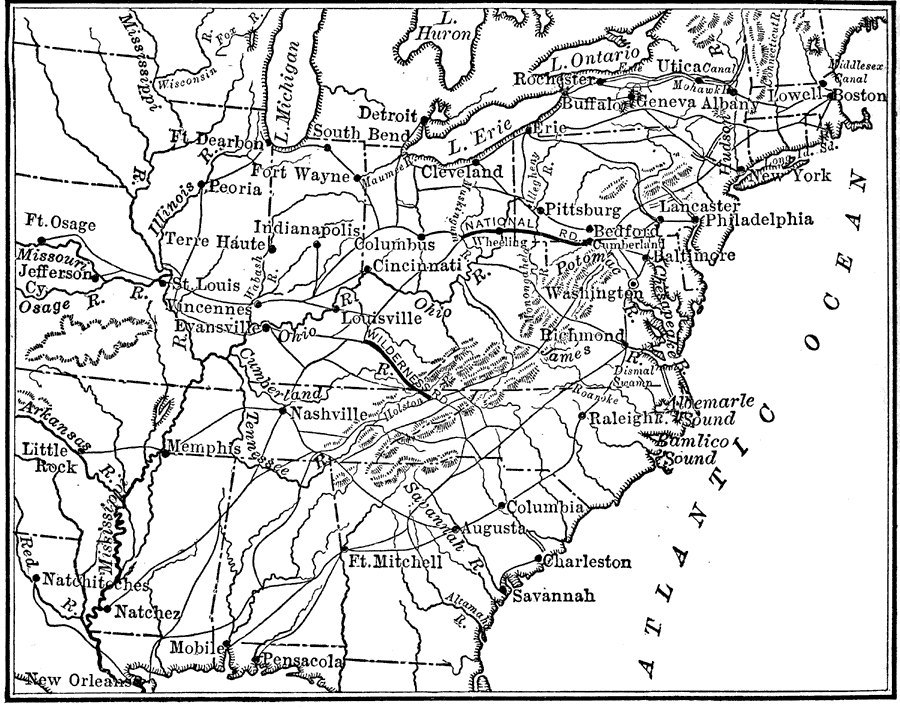
Description: A map from 1825 of the United States from east of the Mississippi River to the Atlantic showing the need for roads to get western produce from the plains across the mountains and to the marketplace in the eastern region.
Place Names: Transportation, Boston, �Indianapolis, �New Orleans, �New York, �Philadelphia, �Pittsburgh, �St. Louis, �Washington D.C., ��Appalachian Mountain
ISO Topic Categories: location,
inlandWaters,
oceans,
boundaries
Keywords: Routes to the East from Western Agricultural Regions, location, �physical, �political, �transportation, kTransportation, physical features, local jurisdictions, roads, location,
inlandWaters,
oceans,
boundaries, Unknown, 1825
Source: Nathaniel Wright Stephenson, An American History (Boston, MA: Ginn and Company, 1913) 292
Map Credit: Courtesy the private collection of Roy Winkelman |
|