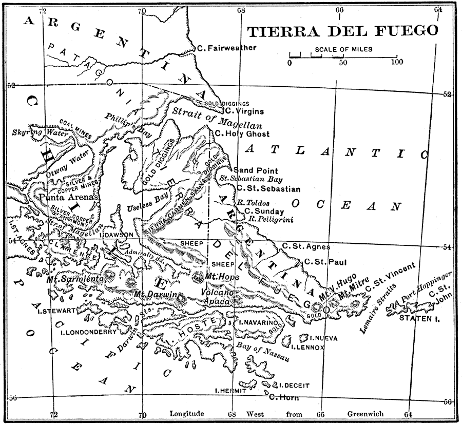
Description: Map of Tierra del Fuego at the southern tip of South America, including Punta Arena (the southernmost city of the world), predominant mountain peaks (Mt. Hope, Mt. Darwin, Mt. Sarmiento), the Strait of Magellan, local natural resources (gold, silver, copper, antimony, and coal mining sites) and agriculture (sheep).
Place Names: A Regional Map of South America, Chile, �Argentina, �Patagonia, �Strait of Magellan, �Cape Horn, �Punta Aren
ISO Topic Categories: boundaries,
inlandWaters,
oceans
Keywords: Tierra del Fuego, physical, �political, �statistical, physical features,
topographical, country borders, industry, boundaries,
inlandWaters,
oceans, Unknown, 1915
Source: Frank G. Carpenter, Carpenter's Geographical Reader: South America (New York, NY: American Book Company, 1915) 158
Map Credit: Courtesy the private collection of Roy Winkelman |
|