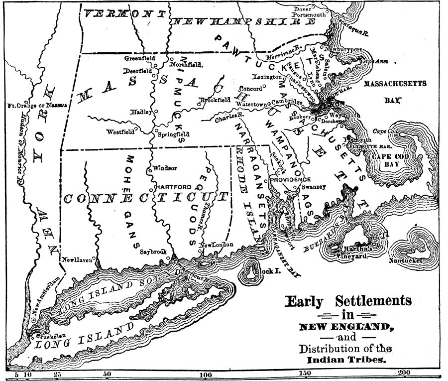
Description: A map of the Dominion of New England (1686), showing the early settlements and the general tribal lands of the Pawtuckets, Massachusetts, Wampanoags, Narragansets, Nipmucks, Pequods, and Mohegans. "New England, a collective name given to six E. States of the U.S. mdash; Me., N.H., Vt., Mass., R.I., and Conn. — including an area of about 68,000 sq. m. The people, mostly descended from an English Puritan and Scottish ancestry, are celebrated for industry and enterprise. This region was granted by James I to the Plymouth Company in 1606, under the title of N. Va., and the coast was explored by Capt. John Smith in 1614." — W. H. DePuy, 1881.
Place Names: Early America 1400-1800, Boston, �Deerfield, �Salem, �Portsmouth, �Nantucket, �Swanzey, �Providence, �New London, �Hartford, �New Amsterdam, �Bruckelen, �New Englan
ISO Topic Categories: boundaries,
inlandWaters,
society
Keywords: Early Settlements in New England and Distribution of the Indian Tribes, physical, �political, �statistical, �historical, �Nipmucks, �Pawtuckets, �Massachusetts, �Wampanoags, �Narragansets, �Pequods, �Mohegans, kNativeAmerican, physical features, major political subdivisions, ethnological, boundaries,
inlandWaters,
society, Unknown, 1686
Source: W. H. DePuy, People's Cyclopedia of Universal Knowledge: V.2 (New York, NY: Phillips & Hunt, 1881) 1230
Map Credit: Courtesy the private collection of Roy Winkelman |
|
