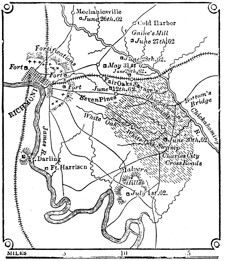
Description: A map of the vicinity of Richmond during the Peninsula Campaign of the American Civil War. "Richmond, the cap. of Va., on the left bank of the James River, at the head of tidewater, 150 m. from its mouth. R. was founded in 1742...In June, 1861, it was selected as the Confederate capital, and from that period was the objective point of a series of formidable military expeditions for its capture, under Gens. M'Dowell, M'Clellan, Burnside, Hooker, Mead, and Grant, and defended by Gen. Lee with a large army and formidable lines of fortifications, until the seizure of the lines of supply by Gens. Grant and Sheridan compelled its evacuation after a series of sanguinary battles, April 3, 1865. A considerable portion of the city was destroyed by the retreating Confederates." — W. H. DePuy, 1881.
Place Names: Civil War, Richmond, �Mechanicsville, �Cold Harbor, �Seven Pines, �Malvern Hill, �James River, �Chickahominy River
ISO Topic Categories: inlandWaters,
transportation
Keywords: Richmond and Vicinity, physical, �transportation, �historical, physical features,
topographical, Civil War, inlandWaters,
transportation, Unknown, 1863
Source: W. H. DePuy, People's Cyclopedia of Universal Knowledge: V.2 (New York, NY: Phillips & Hunt, 1881) 1496
Map Credit: Courtesy the private collection of Roy Winkelman |
|