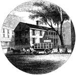
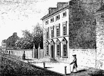
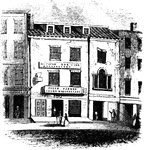
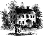
Providence Tavern
"Old Tavern in Providence. This view is from the market, looking north. The building stands on the east…
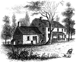
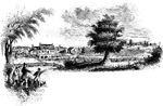
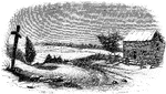
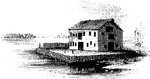
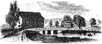
Hubbard's House and Mill
"Hubbard's House and Mill. The inscriptions upon the monument are as follows: East Side: "Oliver Hazard…
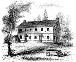
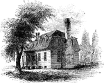
Prescott's Headquarters
"Prescott's Headquarters. This house is on the east side of the west road, about a mile from the bay.…
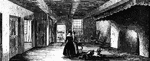
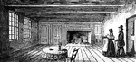
Dining-Hall
"The dining-hall, or room with seven doors. In the December number of the New York Mirror for 1834,…
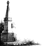
Goshen Monument
"Monument at Goshen. During the battle, Major Wood, of Goshen, made a masonic sign, by accident, which…
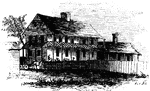
Greene and Knox Head-Quarters
"Head-quarters of Greene and Knox. This view is from the turnpike road, looking southeast. The water…

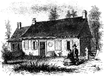
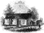
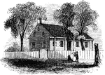
Mrs. Falls'
"Mrs. Falls'. This house, now (1850) owned by Mr. Samuel Moore, is a frame building, and stands on the…
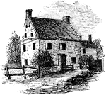
Smith's House
"Smith's House. This view is from the slope in front of the house. The main building is of stone; the…
Breakfast Room
"The Breakfast Room. This is a view of the room in the Robinson House in which Arnold was at breakfast…
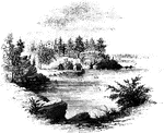
Stony Point
"Rear view at Stony Point. This sketch presents a rear view of the old embankments of the fort, and…
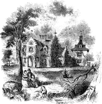
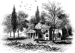
Sunnyside
"View of 'Sunnyside,' the residence of Washington Irving. Built by Wolfert Ecker and known famously…
Tappan head-quarters
"Washington's head-quarters at Tappan. This view is from the yard, near the well. The date of its erection…
Hopper House
"The Hopper House. This view is from the road, looking northeast. The low part, on the left, is a portion…
Friends' meeting-house
"Friends' meeting-house. This view is from the shed in the yard, looking southeast. The building stands…
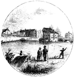
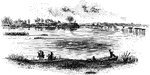
Trenton
"Trenton Bridge and vicinity. This view is from the north side of the Assanpink, a few rods above the…
Princeton battle-ground
"View of the battle-ground near Princeton. This view, looking north, is from the carriage gate of Mr.…
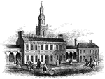
Carpenters' Hall
"Carpenters' Hall. This building is constructed of small imported bricks, each alternate one glazed,…
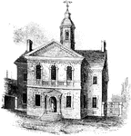
State House
"Walnut Street front of the State House in 1776. This gives the appearance of the shorter steeple, which…
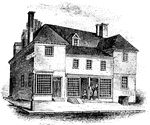
Penn's House
"Penn's House. This view is from Second Street. The building is of imported brick, except the modern…
Howe's Quarters
"General Howe's quarters were in a house on High Street, one door east from the southeast corner of…
Monmouth Battle-Ground
"Battle-ground at Monmouth. This view is from the orchard, upon the site of Wayne's position when Monckton…
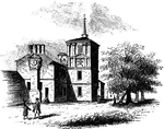
Birmingham Meeting-House
"Birmingham Meeting-house. This is a view of the southerly front of the meeting-house. The building…
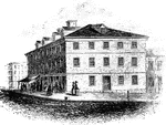
Congress House
"The Congress House. This view is from Baltimore Street, looking southeast. The ront on the left is…
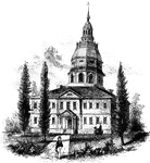
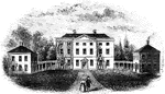
Annapolis State House
"The State House in Annapolis. This fine building is situated upon an elevation in the center of the…
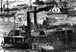
Burning of the White House
"Burning of the White House- the Federal troops, by command of General McClellan, abandoning their position…
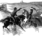
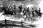
Old Church
"Desperate skirmish at Old Church, near Tunstall's Station, VA., between a squadron of the Fifth United…
Old Church
"Desperate skirmish at Old Church, near Tunstall's Station, VA., between a squadron of the Fifth United…
Grafton Occupied by Federal Troops
"View of Grafton, West Virginia, occupied by the Federal Troops, under the command of General McClellan,…
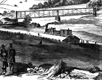
Railroad at Grafton
"View of Grafton, West Virginia, occupied by the Federal Troops, under the command of General McClellan,…
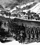
Federal Troops at Grafton, West Virginia
"View of Grafton, West Virginia, occupied by the Federal Troops, under the command of General McClellan,…
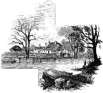
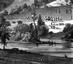
Jamestown Island
"Distant view of Jamestown Island. This view is from the north side of what was once a marsh, but now…
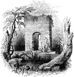
Jamestown Ruins
"Ruins at Jamestown. This view is from the old church-yard, looking toward James River, a glimpse of…
Moore's House
"This is a view from the lawn, looking south. It is a frame building with a brick foundation. At the…
Monticello
"Monticello, Governor Jefferson's place of retirement. This venerated mansion is yet standing, though…
Tryon Palace
"Front view of Tryon's Palace. The view here given was the north front, toward the town. The center…
Guilford Battle-ground
"View of the battle-ground. This view is from the eminence southwest of the site of old Guilford Court…
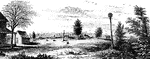
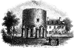
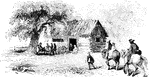
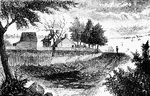
Rocky Mount
"View at Rocky Mount. This view is from the garden-gate at Mrs. Barkley's, looking northeast. On the…
Rugeley's
"View at Rugeley's. This view is from the south side of the bridge. The counterfeit cannon was placed…
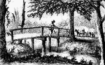
Hobkirk's Hill
"View at the Spring; Hobkirk's Hill. It is at the hed of a ravine, scooped out of the northeastern slope…
McIntosh's House
"Dwelling of General McIntosh. This house is the third eastward from Drayton Street, and is said to…
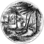
Turtle Bay
"View at Turtle Bay. Turtle Bay is a small rock-bound cove of the East River, at the foot of Forty-seventh…
Washington's Head-Quarters
"Washington's head-quarters. I was informed by the venerable Anna van Antwerp, about a fortnight before…
Gravesend Bay
"View at Gravesend Bay. This view is from the road on the high shore, a little below Fort Hamilton,…
Cortelyou's House
"Cortelyou's House. This house, built of stone, with a brick gable from eaves to peak, is yet (1852)…
Washington's Head-Quarters
"Washington's head-quarters. The house occupied by Washington while the army was at White Plains is…
King's Bridge
"View at King's Bridge. This view is from the southwest side of the stream, from near the tide-mill.…
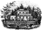
Washington's Quarters
"Washington's Quarters. This is a view of the southwest front of the mansion. The room occupied by Washington…
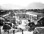
Pompeii
"Excavating a house at Pompeii from eruption of Vesuvius, which buried the cities of Herculaneum and…
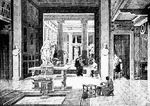
House
"A Roman house. In early times the private houses of the Romans were very simple, showing little attempt…

Charles V
"Charles V ruled over wider dominions than any European sovereign since Charlemagne. He belonged to…

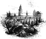
Eddystone Lighthouse
"Eddystone is a group of gneiss rocks, daily submerged by the tide, in the English Channel, 9 miles…