Maps Site map
  Maps > Europe > Greece
Site Map  

  Record   11   to   20  of   53

Historic and contemporary maps of Greece and Hellas, including political and physical maps, early empires, city plans, and battle plans.
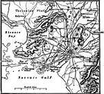
Athens, Greece, 1914
A map of Greece in the vicinity of Athens in 1914, showing the Thriasian Plain, Saronic Gulf, Phalerum Bay, Eleusis Bay, Piræus, Khalandri, Kephisia, Kalyvia, and other cities, roads, rivers, coastal features, and terrain....

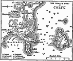
Corfu, 1919
A map of the town and port of Corfu, an island of western Greece, in 1919. This map shows terrain and coastal features such as Kastrades Bay, Vido Island, water depths, and anchorage locations, as well as forts and fortifications in the area, the chu...

Greece with Crete, 1920
A map of Greece in 1920, showing major cities and rivers, with an inset map detail of the island of Crete....

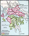
The AEtolian and Achaean Leagues, 229 B.C.
Map showing the Greek &Aelig;tolian and Achæan Leagues, from about 229 B.C. This map shows the &Aelig;tolian confederation of &Aelig;tolia, Oetæa, Phthiotis, Locris, Phocis, Boeotia, Cephallenia, and Elis, and the Achæan confederati...

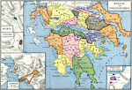
Hellas and Peloponnesus, 300 BC
Map of Hellas and Peloponnesus in 300 BC, during the Hellenistic Period after the death of Alexander the Great. The map is color–coded to show the political divisions of the region, including Acarnania, &Aelig;tolia, Locris, Doris, Phocis, Boe...

Division of the Empire of Alexander the Great after the Battle of Ipsus, 301 BC
A map of the division of the Empire of Alexander the Great after the Battle of Ipsus in 301 BC. This map is color–coded to show political divisions in various regions of the Empire, including the Empire of the Ptolemies in northern Africa and ...

The Empire of Alexander the Great, 323 BC
A map showing the extent of the Empire of Alexander the Great in 323 BC, from Macedonia to northern Africa, across Asia Minor to the Indus River. The inset map show the site of the Battle of the Granicus in 334 BC, near Troy, where Alexander first de...

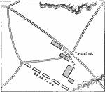
Battle of Leuctra, 371 BC
A map of the Battle of Leuctra, 371 BC, between the Thebans and the Spartans in Boeotia, Greece, showing the military positions, and suggesting the need for innovative tactics by the Thebans to defeat the militarily superior Spartans....

Map of the Hellespont, 405 BC
A map of the Hellespont (Dardanelles) between the Aegean Sea and Propontis (Bosporus), during the Peloponnesian War (405 BC), showing several important sites such as Troy (Ilium) and Abydos, where Xerxes I built two bridges to allow his army to invad...

Greece after the Battle of Mantineia, 418 BC
A map of the Greek territories after the Battle of Mantinea (418 BC) during the Peloponnesian War. This map is color–coded to show the possessions of Athens and allied states, Thebes and allied states, Corinth and allied states, and Sparta and ...

First Previous Next Last


  Maps > Europe > Greece
Site Map  

Maps ETC is a part of the Educational Technology Clearinghouse
Produced by the Florida Center for Instructional Technology © 2009
College of Education, University of South Florida