Maps Site map
  Maps > Globes & Multi-Continent > Regional Maps >Regional Mediterranean
Site Map  

  Record   1   to   10  of   60

Regional Globes & Multi-Continental maps of the Regional Mediterranean region from the Maps ETC collection. This may include physical and political maps, early history and empires, climate maps, relief maps, vegetation maps, population density and distribution maps, cultural maps, and economic/resource maps.
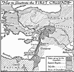
The First Crusade, 1095–1099
A map of the region of the First Crusade launched by Pope Urban II in 1095. This map shows the territory of the Eastern Empire (Byzantine), the Seljuks, the Fatimids, Abbasids, the states set up by the Crusaders, including the County of Edessa, Princ...

The Crusades, 1095–1204
A map of the Mediterranean region showing the principal routes of the European Crusaders to the Holy Lands during the first four Crusades, from 1095 to 1204. The map shows the various routes, indicating those of the Germans, French, and English, with...

The Crusades, 1096–1270
A map of Europe and the Mediterranean Asia Minor region where the Crusades took place from 1096–1270, including the routes of Godfrey of Bouillon, first ruler of the Kingdom of Jerusalem (1096 — First Crusade), to Constantinopolis (Consta...

Ancient Greece and the Coast of Asia Minor, 1100–800 B.C.
Countries bordering the Aegean Sea and the eastern side of the Ionian Sea. ...

Greece and the Orient, 1250 B.C.
Map showing Greece and the Orient....

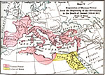
Expansion of Roman Power before the beginning of the Revolution to the Death of Caesar , 133–44 B.C.
Map showing the expansion of Roman power before the beginning of the Revolution to the Death of Caesar (133–44 B.C.), color–coded to distinguish between Roman power and the allies of Rome. ...

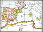
The Spanish Kingdoms, 1360
A map of the Iberian Peninsula showing the Spanish Kingdoms of Mussulmans, Navarre, Castile and Leon, France, Portugal, and Aragon....

Ottoman Empire at Fall of Constantinople, 1453
A map of the Ottoman Empire at the time of the fall of Constantinople in 1453, and is color–coded to show the possessions of the Ottoman Empire in Europe and Asia Minor, Venetian possessions, Genoese possessions, and the Christian States of the...

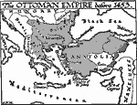
Rise of the Ottoman Empire, 1453
A map of the rise of the Ottoman Empire before 1453 and the fall of Constantinople, showing the territories in northern and western Anatolia, Bulgaria, Serbia, Thrace, Macedonia, and eastern Epirus. The map shows the countries of Albania, Bosnia, and...

The Extent of Roman Power on the Eve of the Third Punic War, 150 BC
A map showing the extent of the Roman Empire and its alliances on the eve of the Third Punic War (149–146 BC). The map shows the territories under direct Roman power, including southern Spain, Cisalpine Gaul, Illyria, Sicily, Sardinia, Corsica,...

Next Last


  Maps > Globes & Multi-Continent > Regional Maps >Regional Mediterranean
Site Map  

Maps is a part of the Educational Technology Clearinghouse
Produced by the Florida Center for Instructional Technology © 2009
College of Education , University of South Florida