| Maps > United States > Forestry |
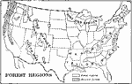 |
The United States - Forest Regions, 1897 Map of United States showing the regions that have forests. |
 |
Forest Regions of the United States, 1911 A map showing the forest regions of the United States. |
 |
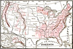
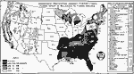
Forest Regions, 1898 AD A map of the Forest Regions in the contiguous 48 states as of 1898 AD. "Fully one third of the timber cut in the world each year comes from the forests of the United States. Indeed, lumbering is carried on so extensively and recklessly in this country that in a few years our best forests will be destroyed unless cutting is more carefully regulated. Lumber, in the shape of logs, beams, boards, and shingles, forms one of our important exports." &mdashRedway, 1898. |
 |
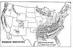
United States Forest Regions, 1901 Forest regions in the United States. |
 |
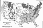
Forest Regions of the United States, 1904 Forest regions of the United States. |
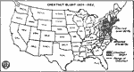 |
Chestnut Blight, 1904-1922 Map showing the range of chestnut blight from 1904 to 1922. |
 |
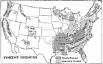
Forest Regions of the United States, 1906 Forest regions of the United States. |
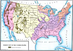 |
Forest Map of the United States, 1910 A forest map of the United States. |
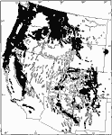 |
Western Forests and Woodlands, 1911 A map showing the distribution of western forests and woodlands. Solid black represents continuous forests, dotted areas represent woodland, that is, a thin scattered growth of forest vegetation. |
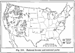 |
National Forests and Parks, 1916 A 1916 map showing the location of forests and national parks in the United States. |
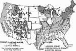 |
Forest Planting Regions in the United States, 1919 A map showing forest planting regions of the United States. The unshaded areas are treeless except along the streams. |
 |
Increasing Distance from Lumber Producers to Lumber Consumers, 1920 Map showing the increasing distance lumber had to travel to go from the production areas in the South and West to the consumption areas in the East. |
 |
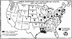
Organized Protection Against Forest Fires, 1922 Map showing the funds dedicated to forest fire prevention compared to the funds needed to adequately protect forest land. |
| Maps > United States > Forestry |
Maps is a part of the Educational Technology Clearinghouse
Produced by the Florida Center for Instructional Technology © 2007
College of Education, University of South Florida