|
|
|
| Maps > United States > Agriculture |
A collection of agricultural production and agricultural related maps in the United States for use in the K-12 classroom.
|
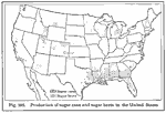
Sugarcane and Sugar Beet Production,
1916 |
|
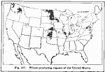
Wheat Production in the United States,
1916 |
|
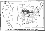
Corn–Producing Regions of the United States,
1916 |
|
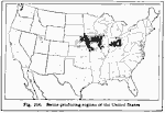
Swine Production,
1916 |
|
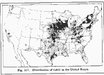
Distribution of Cattle,
1916 |
|
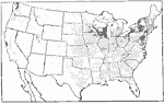
Distribution of Dairy Cows,
1916 |
|
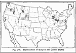
Distribution of Sheep,
1916 |
|
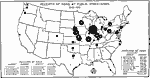
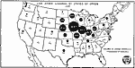
Receipts of Hogs at Public Stockyards,
1916–1921 |
|
Live Stock Loadings by States of Origin,
1918 |
|
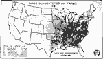
Hogs Slaughtered on Farms,
1919 |
| First | Previous | Next | Last |
| Maps > United States > Agriculture |
Maps ETC is a part of the Educational Technology Clearinghouse
Produced by the Florida Center for Instructional Technology © 2009
College of Education, University of South Florida