|
|
|
| Maps > United States > Agriculture |
A collection of agricultural production and agricultural related maps in the United States for use in the K-12 classroom.
|
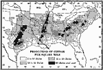
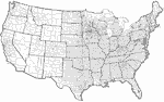
Cotton Producing States,
1910 |
|
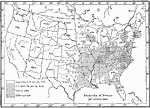
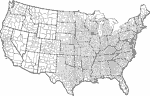
Tobacco Production,
1910 |
|
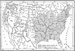
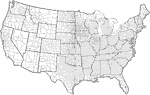
Fruit-Growing Regions in the United States,
1910 |
|
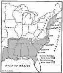
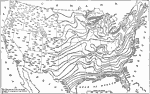
The Regions of Cotton Raising and Manufacturing Areas,
1911 |
|
Cooperative Creameries in the United States,
1913 |
|
Cooperative Cheese Factories in the United States,
1913 |
|
Farmers' Cooperative Elevators in the United States,
1913 |
|
Crop Growing Season,
1916 |
|
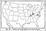
Tobacco Producing Regions,
1916 |
|
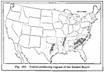
Cotton Producing Regions of the United States,
1916 |
| First | Previous | Next | Last |
| Maps > United States > Agriculture |
Maps ETC is a part of the Educational Technology Clearinghouse
Produced by the Florida Center for Instructional Technology © 2009
College of Education, University of South Florida