Maps Site map
  Maps > United States > Complete Maps
Site Map  

  Record   41   to   50  of   73

Historic and contemporary maps of the United States, including physical and political maps, early exploration and colonization period, territorial expansion maps, climate maps, relief maps, population density and distribution maps, vegetation maps, and economic/resource maps.

The United States, Southern Canada and Northern Mexico, 1904
The United States that shows state and territory boundaries, major cities, railroad lines, canals and navigational rivers. Physical features such as mountain ranges with elevation measured in feet, major rivers and watersheds, and continental shelf b...

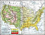
Orographical Map of the United States, 1906
An orographical map from 1906 of the United States showing terrain features including mountain systems, plateaus and slopes, watersheds, lakes, and rivers. The map is color–coded to show land elevations from sea level to over 10,000 feet....

Natural Regions of the United States, 1906
A relief map from 1906 of the United States showing terrain features of mountain systems and highlands, basins, plains, prairies, lakes, rivers, and coastal features....

United States, 1906
A map from 1906 of the continental or ‘lower forty–eight’ United States showing state boundaries and state capitals, major cities and towns, mountain systems, lakes, rivers, and coastal features. Inset maps show the entire North Ame...

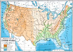
Relief of the United States, 1906
A relief map from 1906 of the United States showing the mountain systems and highlands, plateaus, plains, lakes, rivers, and coastal features....

United States, 1906
A map from 1906 of the continental or ‘lower forty–eight’ United States showing state boundaries and state capitals, major cities and towns, mountain systems, lakes, rivers, and coastal features. Inset maps show the entire North Ame...

United States, 1907
A map from 1907 of the ‘lower forty–eight’ United States showing state boundaries and state capitals, major cities and towns, mountain systems, lakes, rivers, and coastal features. An inset map details Alaska....

The United States, 1910
A map from 1910 of the United States showing general elevations, water depths, watershed boundaries, and terrain features, including the Pacific Slope, Great Basin, Colorado Plateau, Cordilleran Highlands, Rocky Mountains, Great Central Plain, Missis...

Relief of the United States, 1910
A relief map from 1910 of the United States showing the physical features of the New England Highlands, Adirondacks, Appalachian Plateau and Mountains, Piedmont Plateau, Coastal Plains, Lake Superior Highlands, Red River Valley Plains, Mississippi Va...

Cities in the United States, 1910
A map from 1910 showing the general distribution of the principal cities and towns in the United States at the time....

First Previous Next Last


  Maps > United States > Complete Maps
Site Map  

Maps ETC is a part of the Educational Technology Clearinghouse
Produced by the Florida Center for Instructional Technology © 2009
College of Education, University of South Florida