Maps Site map
  Maps > United States > Early America 1400-1800
Site Map  

  Record   81   to   90  of   199

A collection of historic maps of early America from explorations and settlements of the English, French, and Spanish, to the end of the American Revolutionary War.

Fort William Henry, 1757
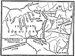
A plan of the British Fort William Henry on Lake George, New York. The fort was the site of the Fort William Henry Massacre (1757) during the French and Indian War. No explanation of the map key is given in the text....

Claims in North America, 1760
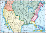
A map of North America in 1760 showing the territorial claims at the time. The map is color–coded to show the claims of the French, English, and the Spanish. The Oregon Country is also shown, however this was a region unexplored by the European...

Old Claims in the Present Territory of the United States, 1763
A map of the present day territory of the United States, showing the European claims to the land before 1763 and the end of the French and Indian Wars. The map shows the claims of the British, French, and Spanish, and shows the unexplored territory o...

The Western Frontier and Pontiac's Rebellion, 1763
A map of eastern North America and the Northwest Territory in 1763 during Pontiac's Rebellion at the end of the French and Indian Wars. The map shows the general tribal lands east of the Mississippi River of the Ottawa, Potawatomi, Wandot, Seneca, Ir...

Native American Delimitations, 1763–1770
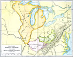
A map of the American colonies and territories west to the Mississippi River between the end of the French and Indian War of 1763 and the beginnings of westward expansion of the trans–Appalachian colony proposed in the Vandalia Project (1770), ...

Proposed Western Colonies, 1763–1775
A map of the territory east of the Mississippi River and west of the Allegheny Mountains showing the proposed western colonies from 1763—1775. The map shows the proposed colony of Charlotiana (1763) between the Mississippi River to the west and...

West Florida Under the English, 1763–1780
A map of West Florida as a British possession between 1763 and 1780. In 1763, the King of Great Britain by royal proclamation limited West Florida on the west by the Mississippi River, on the north by the 31st parallel, on the east by the Chattahooc...

British Possessions in North America, 1765
A map showing the British possessions in North America in 1765 after the French and Indian War, as defined by the Treaty of 1763, Proclamation of 1763, and the Royal Orders of 1764–1767. The map shows the British Colonies on the Atlantic, major...

Designation of Members to the General Stamp Act Congress, 1765
A map of the British Colonies showing the colonies participating in the Stamp Act Congress of 1765 held in Federal Hall, New York City. The map shows the number of delegates from each colony, and the colonies that refused to call legislature (Georgia...

The Iroquois Country, 1768
A map of the Finger Lakes region of Upstate New York showing the Iroquois Six Nations lands as established by the Fort Stanwix treaty of 1768. The map show the expansion of English colonial settlers into the upper Hudson River Valley area, including ...

First Previous Next Last


  Maps > United States > Early America 1400-1800
Site Map  

Maps ETC is a part of the Educational Technology Clearinghouse
Produced by the Florida Center for Instructional Technology © 2009
College of Education, University of South Florida